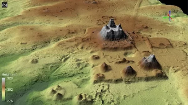
Geologists in northern Guatemala have discovered a massive Maya site that stretches approximately 650 square miles (1,700 square kilometers) and dates to the Middle and Late Preclassic period (roughly 1000 B.C. to 250 B.C.).
The findings were the result of an aerial survey that researchers conducted via airplane using lidar (light detection and ranging), in which lasers are beamed out and the reflected light is used to create aerial imagery of a landscape. The technology is particularly beneficial in areas such as the rainforests of Guatemala’s Mirador-Calakmul Karst Basin, where lasers can penetrate the thick tree canopy.
Using data from the scans, the team identified more than 1,000 settlements dotting the region, which were interconnected by 100 miles (160 kilometers) of causeways that the Maya likely traversed on foot. They also detected the remains of several large platforms and pyramids, along with canals and reservoirs used for water collection, according to the study, which was published Dec. 5 in the journal Ancient Mesoamerica (opens in new tab).
“Writer Fuel” is a series of cool real-world stories that might inspire your little writer heart. Check out our Writer Fuel page on the LimFic blog for more inspiration.

